Attachments functionality has been available from ArcGIS Desktop 10.3 and is included in ArcGIS Pro.
Geodatabase attachments are a more powerful way of associating non-geographic data with geographic data than traditional hyperlinking because you can associate multiple files with a feature, store the attached files in a geodatabase and access the files in more ways. Attachments are also preserved when publishing layers online.
ArcGIS Pro attachments can be viewed using just a Basic licence, but you do need a Standard or Advanced license to create them.
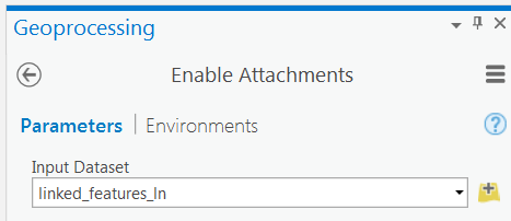
The following workflow describes how to create attachments for a feature class.
Firstly, attachments need to be enabled for the feature class. This creates an attachment relationship class and an attachment table which internally stores attachment files.
The attachment table is empty until attachments are added in the next step.
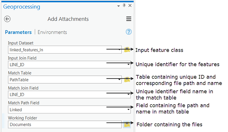
Attachments are added to the feature class using the Add Attachments tool. The easiest way to start adding attachments is to have a standalone table that contains a unique identifier for each feature and the file path to the file to be attached. If you do not have this table, you can create one using Generate Attachment Match Table.
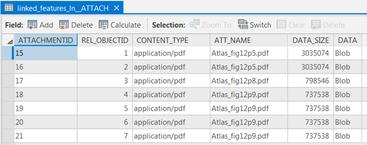
Add Attachments populates the attachment table with the required information to create the relationship.
The populated Attachment table:
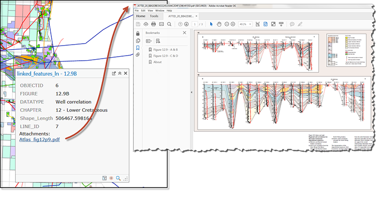
The attached files can now be accessed using the Explore tool. In this example, the attached documents are PDFs, so the pop-up displays a hyperlink which launches a PDF viewer. To view the attachment hyperlink in the pop-up window, go to the Properties of the layer and select Configure Pop-Ups. Check that Show list of attachments is ticked.
And there you go…the associated files can be easily managed and retrieved.
Find out more about how we can help you with ArcGIS Pro.
Posted by Devlyn Robson, Senior GIS Consultant


