Having released our ArcGIS Pro version of Unconventionals Analyst – along with hearing about more oil and gas companies making the switch from ArcMap to ArcGIS Pro – I thought it would be useful to highlight some of my favourite features in the software to help customers using this fantastic tool for US onshore development projects get up-and-running.
1. Treat leases as contiguous
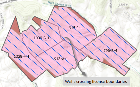
This feature is really useful if you have several licenses that you want to model with a single drilling pattern. Tick on the Treat as contiguous box and the Create Well Sticks tool will consider the individual licenses in your dataset as one large license – fitting laterals continuously across license boundaries.
2. Different drilling azimuths for different leases
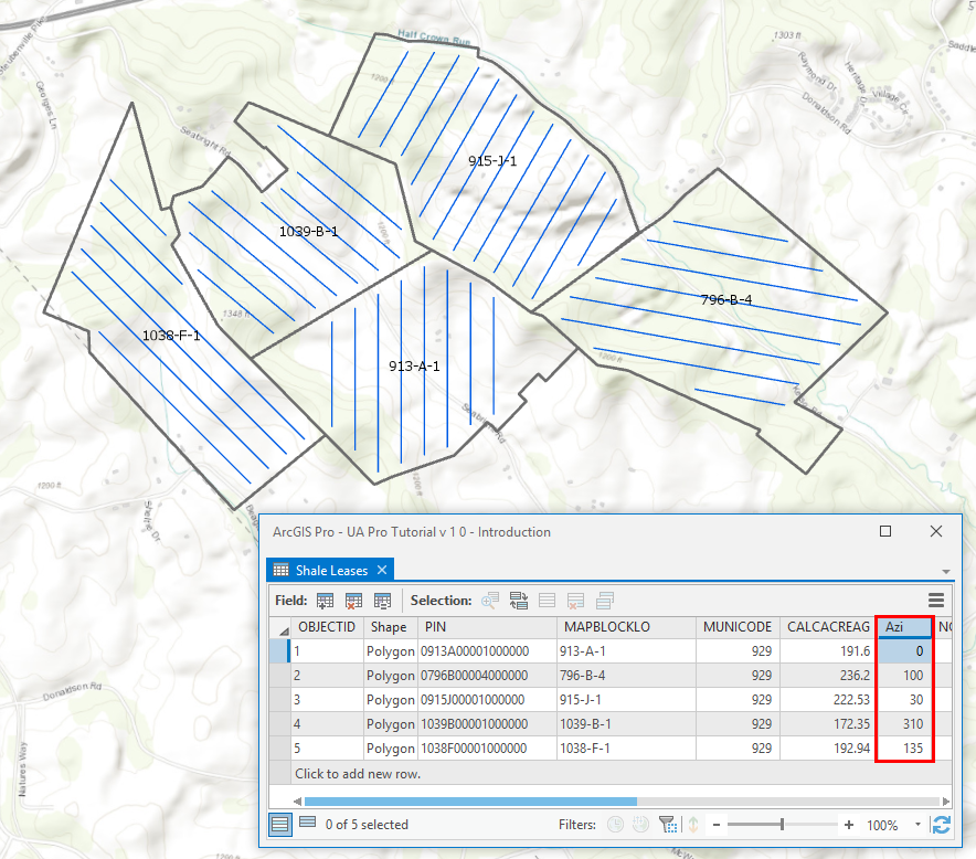
If you’ve got a set of leases that need different drilling directions, this feature makes well modeling really easy – simply specify the Attribute that contains the Azimuth data and the tool will orientate wells in the direction specified.
3. Allow pad placement out of DSU
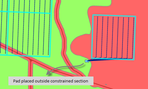
If you’re working in an area where it is not possible to model a well pad within a lease or section due to constraints to operations, then this new option will instruct the software to seek alternatives. Tick on the Allow out of DSU option in the Create Development Plan tool and the software will be able to model a well pad outside of a section or lease even if it previously looked ‘off limits’ due to drilling constraints.
4. Force landing point to setback
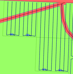
To maximise the horizontal section of your license laterals use the Force landing point to setback option. This option will kick the heel of wells back to the Setback area thus maximising the producing part of the wells to drain a larger area within your licenses.
5. Creating well laterals that track horizons
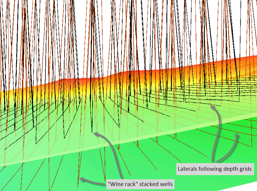
One of the coolest features in the well modelling tools is to be able to create 3D enabled well data, and you can create really compelling results if you generate laterals that follow the surface of the target interval. In the example below I’ve specified the Depth Mode as Raster and selected depth grids for the 2 levels the “wine rack” well configuration is targeting: Wolfcamp A and Wolfcamp D. I’ve told the software to create lateral geometries with Z values based on these depth grids and so the output well geometries now track the targeted horizons.
6. Selecting from the Analyze Well Production graph
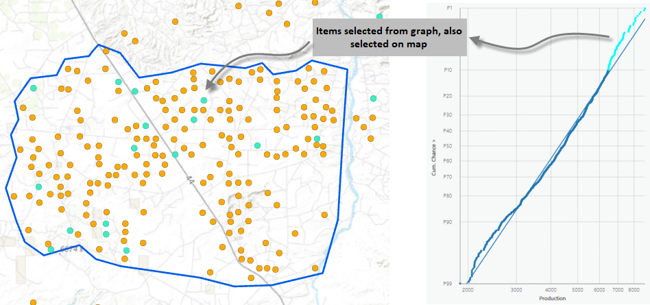
Within unconventional plays, often we’re most interested in the wells with the top 10% of production. The spatial relationships between these super producer wells could unlock further potential in terms of sweet spot analysis, so knowing where they are is essential. The Unconventionals Analyst production analysis tools provide full 2-way interaction between the graph and the map features, which makes this workflow really easy. Use the ArcGIS Pro Select by Rectangle tool to click and drag a selection on the production graphs and the wells will be highlighted on the map. This feature was requested by our customers, and we listened!
7. Scheduling wells
Exploration manager: If we use the well plan you’ve developed how long will it take and when will the drilling program finish?
Past me: Let me go and talk to the drillers, I’ll get back to you tomorrow.
Unconventionals Analyst me: Give me a minute to run the Schedule Assets tool.
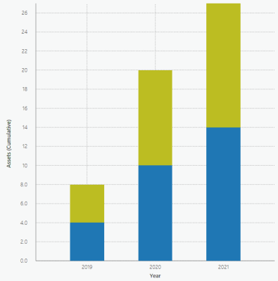
Simply input the number of concurrent rigs you’ll have running; how long it takes to drill the average well; and a start date for the drilling campaign and the software will create drill dates for all the wells as well as graph the rig activity per year.
8. Dark Theme
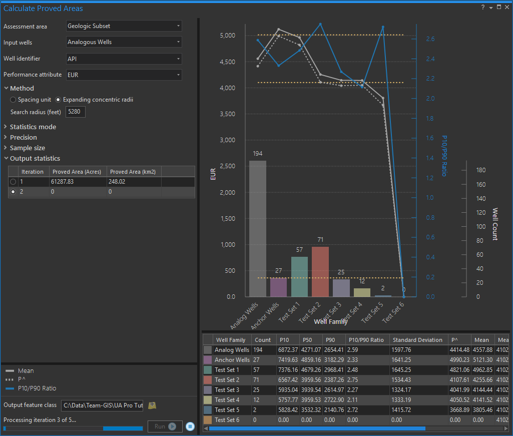
I use ArcGIS Pro a lot. The default Light Theme can be quite bright and over prolonged periods can strain your eyes. Try Dark Theme instead and check out our cool application icons and graph displays!
To learn more about Unconventionals Analyst please see our website and if you’re interested to try it out on your own projects and data please contact us to arrange a trial.
Posted by Rich Webb, Product Specialist, Exprodat


