
Digitising is one of the most common GIS tasks that geoscientists want to be able to perform. Maps in presentations or journal articles contain useful information which may only be available in a non-spatial format, so the geoscientist needs to be able to georeference the image and then start digitising their own data.
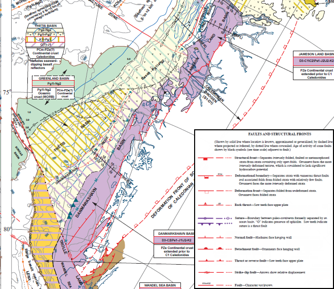
Figure 1: Portion of a map of the Arctic region showing various structural features (after Grantz et al., 2010)
The approach that most people use when digitising, is to draw in the selected features, add the necessary information to the attribute table and then use the attribute information to create their symbology.
This is a perfectly acceptable way to digitise one or two lines that have short, simple descriptions. However, if you have a large variety of feature types, with complex or lengthy descriptions, you may find yourself spending hours repeating the process of creating the symbols and adding the attributes, with the added risk that one or two attribute values may be entered incorrectly.
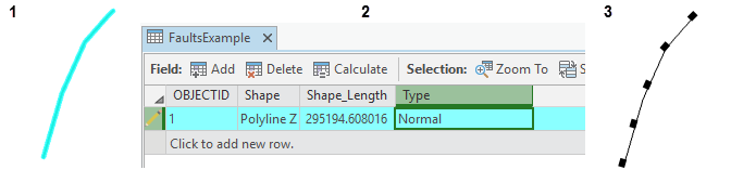
Figure 2. An example of the usual digitising workflow. First digitise the fault line, add the attribute information then choose the symbology.
The video lesson at the end of this Blog shows how to use ArcGIS Pro’s editing capability to do this. The workflow can be summarised in the following steps
1.Create a feature class and add fields to an attribute table to capture the various types of structural features to be digitised.
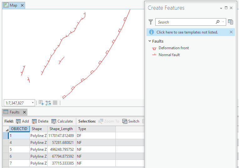
Figure 3. Save time digitising using feature templates.
2. Use advanced symbology settings to create fault symbols which match the source data you will be digitising from before you digitise the features, saving you the hassle of creating and adding the symbology after each edit
3. Add the attribute information which will be used by default for that type of symbol, automatically. You don’t have to worry about typing the same description in multiple times
4. Digitise and modify fault lines using the editing geoprocessing tools and save those edits. Editing in ArcGIS Pro is always switched on so it is important to remember to save your edits as you work.
As you can see, digitising has become even easier in ArcGIS Pro, with improved symbology customization and more efficient editing tools. If you’re interested in learning to use ArcGIS Pro in your petroleum workflows, check out our ArcGIS Pro Essentials for Petroleum training course.
Posted by Devlyn Robson, Senior GIS Trainer, Exprodat.
Image taken from Grantz, A. and Scott, R. A. and Drachev, S. S. and Moore, T. E. and Howard, J. P. (2010) Map showing the sedimentary successions of the Arctic region (58°-64° to 90°N) that may be prospective for hydrocarbons. American Association of Petroleum Geologists)
Training Tip 31: Get digitising with ArcGIS Pro


