
It’s over ten years since the International Association of Oil and Gas Producers (IOGP) Geomatics Committee released the seabed survey data model (SSDM), which helped standardise the management of seabed survey data – of enormous value to offshore operators to help plan and mitigate risks associated with drilling, pipeline and other production and decommissioning operations through the identification of geo-hazard, debris, environmental, debris and seafloor features. As the energy transition continues, the offshore model becomes relevant to other sectors, such as wind farm installation and CCS operations.
Recently, the IOGP released a ‘sister’ model to support data management of features mapped during onshore surveying for oil and gas exploration and production, called the Land Survey Data Model (LSDM). The land model defines standards for storing spatial and non-spatial features associated with the large amount of data collected during onshore survey operations.
LSDM supported survey types and activities listed by the IOGP guidelines include: proposed, as-found, as-built infrastructure or facility surveys; topographic surveys; land survey measurements for UAV/LiDAR operations; vegetation and land use; imagery surveys; right of way surveys or surveillance (e.g. pipeline route, facility inspection, access roads); geotechnical and geophysical surveys; admin boundary or culture information; and environmental surveys.
These data are often stored in many formats, such as CAD, tables, reports, images, point clouds and others. Having a consistent framework for their management enables easier storage, sharing and integration of this data. This in turn helps the complex infrastructure associated with onshore energy processing facilities to be maintained, monitored and managed more efficiently.
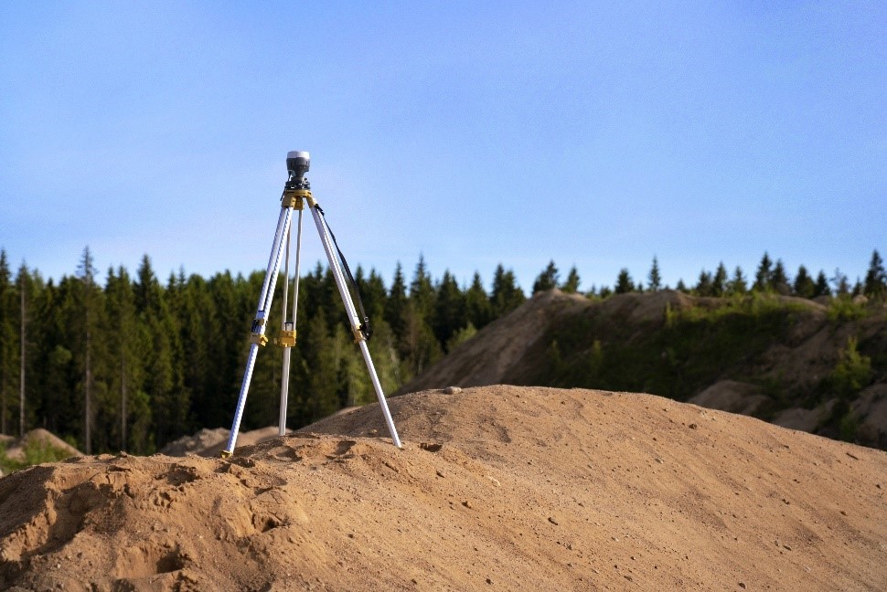
Figure 1: Land Survey Equipment
What does the model consist of?
The model can be downloaded from the IOGP site and consists of:
- Data Dictionary – an extensive word document detailing the model including structure, hierarchy, feature classes, tables.
- Data Model Template – contains the Esri File Geodatabase (FGDB) template, XML schema, enterprise architecture project.
- Data Model Guidelines – contains user guidelines.
- Metadata – contains XML metadata files that can be assigned in ArcGIS Desktop.
- Feedback – there is also a feedback form on the IOGP website.
How is the LSDM manifested in ArcGIS?
The FGDB contains five feature datasets to provide logical groupings, and enforce a common spatial reference on feature classes within it. A series of tables store additional data. These have been designed to standardise the data associated with land surveys. They feature datasets are:
- Environmental Samples – five feature classes (FCs) to store data associated with various environmental properties (soil, water, air, fauna, flora).
- Infrastructure – 12 FCs for storing details on owned or operated infrastructure and facilities, such as pipelines, production plants, camps, electrical and telecommunication utilities, offices, road and railway.
- Shallow & Intermediate Geology – 16 FCs for storing features associated with geohazards, such as faults, buried channels, shallow gas.
- Survey Measurements – 11 FCs for survey information – keysheet, chart outlines, extents of survey equipment, etc.
- Surface Geomorphology – 8 FCs for elevation, topography, land use/cover and surface geology.
- Additionally, 4 tables in the root of the geodatabase can be used to store survey details such as equipment and coordinate reference system (CRS) information.
Each feature class contains predefined attributes with subtypes and domains to control population of key fields. GUIDs link related features in different feature classes – for example, so you can find the survey details for a given piece of telecoms equipment from the survey keysheet. These ensure the data is stored in a logical, consistent manner.

Figure 2: IOGP LSDM version 1 diagram
Here are five tips on getting the most out of LSDM…
Get the foundations right
Once you’ve downloaded the model, review the physical model and supporting documentation to understand how it fits together, and how it can meet your needs.
It’s worth spending time on data governance up front to decide how best to use the model, and how it fits into existing data and workflows. Here are a few things to consider:
- Is the model suitable for your needs? If not, can it be modified, e.g. to add additional FCs, or modify the schemas to include additional attributes – or, even, used at all? You may need to consider your existing land survey data, and how partners or contractors currently work with the data, as well as end user’s requirements.
- Is there existing data, or an existing data schema, to map into the model? This may require an exercise to match datasets and attributes from existing data into the data model.
- What processes need to be updated to work with the model, and ensure it’s embedded in workflows? Factor in the team who process and manage the data, as well as those who need to use the end results.
- How will the data be stored? For companies with a limited geographical scope, it may make sense to combine all survey data into one single set of FCs, which can be distinguished by the survey refs / IDs / names. This isn’t possible where more than one CRS is required, e.g. where data covers more than one region or country – since each FC has a pre-defined CRS. In this case, multiple datasets will be required – think about how these should be stored and distinguished – all within an Enterprise Geodatabase, or in standalone FGDBs.
- How will the data be shared with end users? The specific problem you’re trying to solve will impact how you share, e.g. via web apps, dashboards and desktop applications. This is worth considering up front, as it will likely also impact how to store the data, the suitability of the model, the symbology used and how metadata is populated. As with any change, don’t neglect the need for change management, to gain buy-in from relevant stakeholders.
Get the contractor to do the work
For operators, ensure your T&Cs with the survey contractor task them with delivering you data in the data format you need – i.e. LSDM format.
To support this, the IOGP guidelines (report 640, page 9) list the pre-requisites to provide contractors, namely: model template (including any company-specific amendments); survey job particulars (Survey ID, project description, survey name, scope of work, etc.); and related existing company data (for context). Importantly, specify the CRS for the survey project.
By default, the LSDM datasets are in WGS1984 Geographic spatial reference (EPSG code: 4326) – clearly, this will not be suitable for many projects, especially given detailed surveys. The CRS information provided should include epoch and transformations.
Automate data loading
CAD is often used to store survey data and is therefore likely to be a key source of LSDM. CAD files can be read and imported directly into ArcGIS. Once imported, the survey keysheet, survey equipment limits and chart index FCs are typically the first to be populated, as the survey ‘hangs off’ these.
The features from CAD or other input files can then be loaded into the relevant LSDM FC. Consistent input data is key to making the data loading process as painless as possible, for example for the layer names used in CAD – a junction box is always named as JunctionBox, not sometimes as Junction Box or JunctoinBox, or 10_JunctionBox. There are core attribute fields to populate – i.e. those which are common to all FCs (e.g. survey ID), as well as attributes specific to different FCs.
Automating these tasks as much as possible helps speed and increase consistency in the output data.
At Exprodat we use a template ArcGIS Pro project with Tasks and custom tools created using the arcpy Python module to step the data processor through each part of the process:
- Our loading component uses an algorithm to identify which FC a particular CAD layer was added to in previous data loads, and, based on this, suggests which similarly-named layers should be added to this time around.
- We can then modify these suggestions based on additional knowledge of the data, and then run a tool to import the CAD into specific LSDM FCs.
- Additional steps populate attributes – where possible scraping this from the available CAD or supporting information.
- ArcGIS Pro Tasks can also be used to automate QC the data – e.g. check population of attributes, geometry checks, topology rules. Inevitably, some manual intervention and QC are also required, but these steps help reduce that and ensure consistency in the data generated.
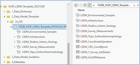
Figure 3: IOGP LSDM version 1 – contents of download folder, including FGDB model
Convert legacy data
You may well have old land surveys in CAD or GIS format that require conversion to LSDM. Converting these into the data model gives a consistent view of how facilities have and are changing over time, to help identify trends and for environmental audit and regulatory purposes.
Converting the data in this way also reduces the risk of losing data in non-standard formats, or which may otherwise be buried in siloed folders or systems.
There are plenty of tools within ArcGIS to help you do that. Again, we’ve created a series of workflows in ArcGIS Pro to streamline this process.

Figure 4: Automate Conversion of Legacy Data
Share the data
As noted in our previous blog on submitting offshore infrastructure data to NSTA, once the headache of data management is reduced, gaining additional value and insights from the data becomes easier. LSDM can be linked to other associated data models – such as linking the utilities components with data in a pipeline or utilities data model (e.g. UPDM, PODS), to provide a consistent data connection between facilities and pipelines/utilities.
LSDM can provide a stepping-off point to a further level of facility detail, linking to the ArcGIS Indoors information model.
Bringing all this into apps using ArcGIS Portal or ArcGIS Online provides easy access alongside other operational data to support workflows like building a common operating picture for HSSE, filtering and viewing facility and land changes over time, or planning new engineering projects. Data exchange with partners and stakeholders also becomes easier when a consistent model is in place.
We’ve been fortunate enough to have worked with pre-IOGP versions of LSDM data for over five years…if you need any help, please get in touch!
Posted by Ian Peebles, Head of GIS Services
References:
IOGP releases Land Survey Data Model (LSDM)
https://www.iogp.org/blog/news/iogp-releases-lsdm/
New guidance supports use of the Land Survey Data Model
https://www.iogp.org/blog/news/new-guidance-supports-use-of-the-land-survey-data-model/
Land Survey Data Model package (template and guidelines)
https://www.iogp.org/bookstore/product/lsdm-package/


