It’s been nearly 3 years since Esri announced that the technology we’d been using for years was now “a platform”. I think it’s fair to say people were initially confused.
Fast forward a couple of releases and Esri’s technology stack has matured significantly, and with it their ArcGIS Platform offering.
We’re now seeing the realisation of this vision – using ArcGIS Platform technology to deliver maps and location analytics to people who don’t know or care what “GIS” stands for. There are even some compelling use cases that demonstrate this in action, such as Seneca Resources.
To someone who understands GIS, this is a “no-brainer” – delivering easy-to-use maps based apps to people who aren’t experts. But what about in Exploration – these guys already have GIS – can they benefit from the platform too?
Even for a group of people as GIS-savvy as Exploration, I believe there are clear benefits in moving to a platform approach. I like to think of these being in 4 key areas.
1. Enable
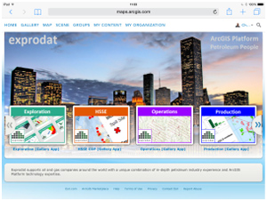
The feedback we’ve had when deploying the ArcGIS Platform at customer sites is that end-users really take to it. They like the simple destination provided by ArcGIS Online or Portal for ArcGIS, and the way they can easily find and run the apps they need to do their job.

2. Analyse
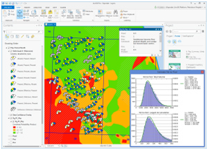
We’ve long been champions of the unique spatial + statistical analysis provided by GIS, and have even developed productivity tools that extend and focus ArcGIS for Desktop to speed up common upstream workflows and solve upstream business problems. With the ArcGIS Platform these data and analysis results can be de-coupled from the desktop, and easily made available across the organisation to non-specialists.

3. Share
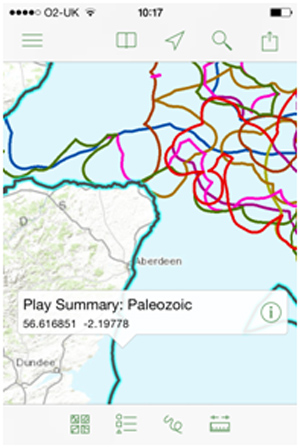
Esri suggest that we can now “discover, use, make, and share maps from any device, anywhere, at any time”. Why would we want to do this, in Exploration? Let’s assume you and some colleagues are in a data room at a potential partner’s office to look at farming-in to some prospects. Can you use your phone to find the nearest pub to discuss things afterwards? Sure. Can you use your phone to look at your company’s view of the same acreage? Probably not…

4. Integrate
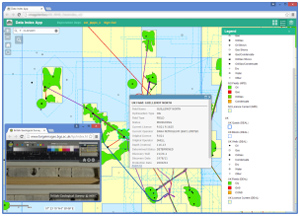
Few applications get close to GIS technology for being able to integrate and synthesise all of your data together in a single environment – desktop GIS users have known this for years. What’s emerging with the platform approach is that it enables you to deliver integrated views of key business data and maps to non-GIS users too (that probably includes your boss and senior managers), via simple to use apps and maps, like web-based maps, Story Maps or on an iPad.

It’s free!
The ArcGIS Platform has matured, and I believe it’s time for oil and gas companies to re-think how they use GIS. After all, they have access to most of the technology already – it’s freely available with the standard “desktop” and “server” products they already own.
See it in action
We recently held a Webinar called “The ArcGIS Platform advantage for Exploration teams” which discusses and demonstrates the above in more detail. If you’re interested you can view a recording via the Members page on our website, or if you’re attending this week’s EAGE conference in Madrid, visit us at booth 962 to find out more.
Posted by Chris Jepps, Technical Director, Exprodat.


