How to calculate the true distance over a surface
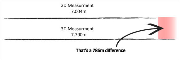
A point-to-point distance taken from a map does not provide a true measurement of the distance between those points; I have to take the intervening topography into account, as shown below.
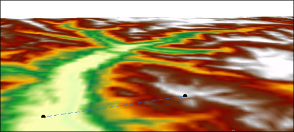
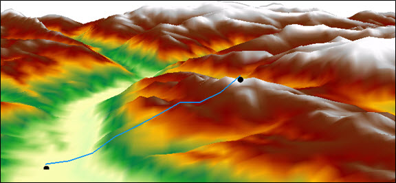
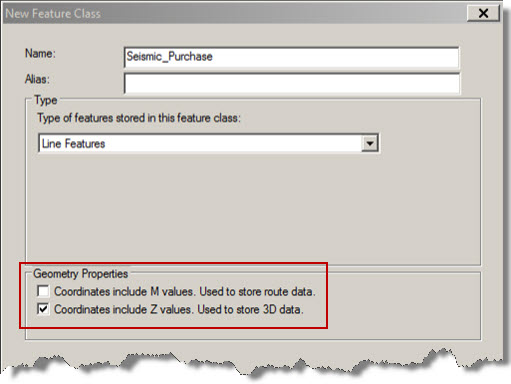
To calculate the 3D length of a line (in ArcMap, with the 3D Analyst extension) the first thing I need to do is to create a new line feature class and enable Z-Values on its geometry:
I can then create lines representing the features that I’m interested in deriving accurate measurements information for, e.g. the 2D seismic lines shown below:
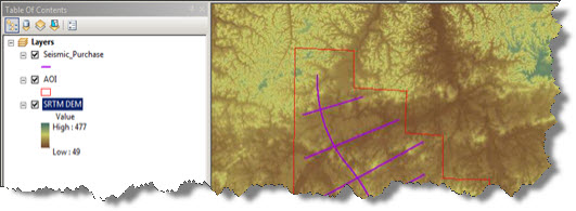
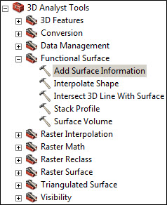
Running the tool…
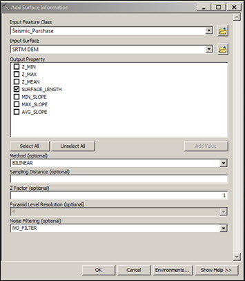
The Add Surface Information tool in the 3D Analyst Toolbox enables me to use the underlying DEM to add an assortment of attribute data to the line feature class.
In this example I am only adding the surface length when associated with the underlying DEM. However, if I’ve created the line as a multipart feature I can also add the min, max and mean elevation value and slope values:
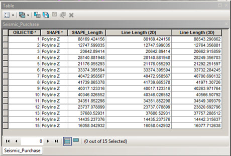
The resulting measurements are shown below, note the difference in value for 2D and 3D line lengths:
The next step…
Of course, the 3D Analyst extension allows me to do more than use calculate lengths – using the 3D analyst toolbar I can create a vertical profile of a line to visualise changes in topography along that line.
To do this, I click the Layer drop-down arrow on the 3D Analyst toolbar and select the surface that I want to profile, then click the Interpolate Line button.

This tool allows me to digitize the proposed route:
• First I click the surface and digitize the line I want to profile. When I have finished, I simply double-click to stop digitizing.
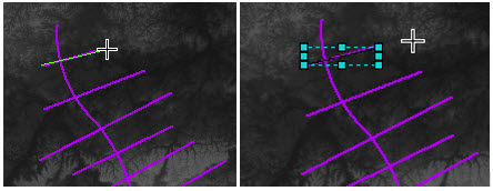
Note: multiple lines can be drawn and compared in the graph.
• Now I’ve got my line, I click the Create Profile Graph button profile graph button to construct a graph.

Note: I can right-click the graph to view and change its properties, such as the graph type used.
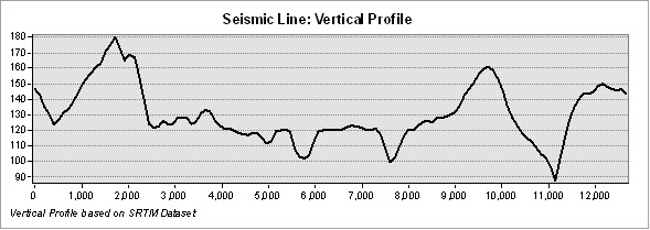
This article touches on only a small amount of what can be achieved using the 3D analyst. Further analysis for the above scenario could include using the Raster Surface toolset for calculating aspect and slope angle which can be important factors when acquiring seismic.
![]() Watch this blog as a video: Calculating True Distance Over a Surface using ArcGIS
Watch this blog as a video: Calculating True Distance Over a Surface using ArcGIS
Posted by Simon Kettle, GIS Consultant, Exprodat.
Many thanks to the following colleagues who helped review this article: Devlyn Robson, Mike Phillips and Fiona Buckingham.
• Related Exprodat course: ArcGIS 3D Surface Analysis for Petroleum


