A recent Exprodat blog looked at geodetic integrity within ArcGIS Pro. This blog follows-up on that great information by providing you a quick tip for importing coordinates into ArcGIS Pro.
In ArcMap it was possible to use the Display XY Data tool to generate a temporary point event layer showing the locations of your coordinates. A similar tool in ArcCatalog, Create Feature Class From XY, generates a point feature class of the input coordinate locations. However, for data in a geographic coordinate reference system (i.e. latitude and longitude), these tools worked best when the input coordinates were in decimal degrees, which is often not the case.
ArcGIS Pro can convert coordinate reference notation in any of the following formats and display the locations as points using the Convert Coordinate Notation tool.
Supported formats:
• Decimal degrees (DD)
• Degrees decimal minutes (DDM)
• Degrees-minutes-seconds (DMS)
• Global Area Reference System (GARS)
• GEOREF (World Geographic Reference System)
• Universal Transverse Mercator (UTM)
• United States National Grid (USNG)
• Military Grid Reference System (MGRS)
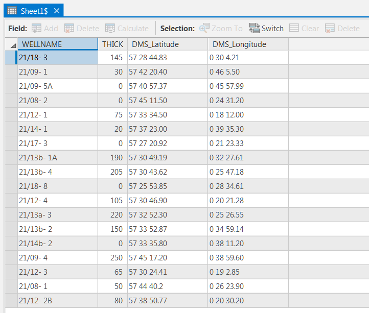
In the example table, coordinates are in a space separated DMS format.

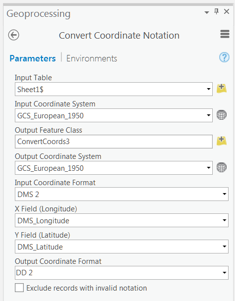
Using the Convert Coordinate Notation, you can specify the input coordinate format. For DD_1, DDM_1, and DMS_1, the latitude and longitude values are concatenated into a single string and stored in a single field. For DD_2, DDM_2, and DMS_2, the latitude and longitude values are represented by two separate fields. For DD_NUMERIC, the latitude and longitude values are stored in two separate fields of type double whilst GARS, GEOREF, UTM_ZONES, UTM_BANDS, USNG, and MGRS are single-string coordinate formats, meaning only one field contains the coordinate.

I have specified that the output notation should be decimal degrees in two fields.
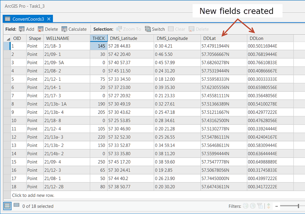
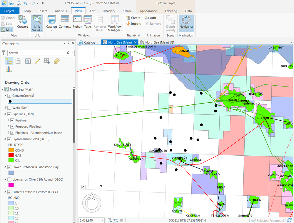
After running the tool, the following point feature class is created and the attribute table contains two new fields (DDLat and DDLong).


Voila! A simple workflow for creating points from coordinates in various coordinate notations!
For more help with this or any other aspect of getting up to speed with ArcGIS Pro, take a look at our ArcGIS Pro services, which we’ve designed to help you get up and running with ArcGIS Pro as fast as possible.
Devlyn Robson
Senior GIS Consultant


