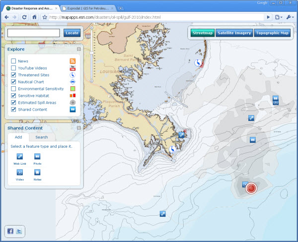
With the imminent arrival of ArcGIS Server 10 and its template-based online spatial data editing it looks as though map-based crowdsourcing (which has been around for a while via Google Earth etc.) will soon be a reality for the ESRI community.
ESRI themselves have quite a neat example of this available on their website, monitoring the BP/Deepwater Horizon oil spill in the Gulf of Mexico. Its simple editing interface allows the public to post up links, photos, videos and notes, in an attempt to increase everyone’s awareness of activities related to this tragic event.
This started me wondering how this type of online editing might be applied to the upstream domain, and specifically within oil exploration, as a type of ‘private crowdsourcing’ (forgive the neologism!) – i.e. internally within an organisation’s firewall.
A few examples where I think it might prove useful are:
- Data integration in play fairway mapping?
- Use as a geological analogues database?
- Competitor acreage tracking/scout database?
- Project team document management solution?
- Virtual team collaboration and data compilation?
It’ll be interesting to see how this area develops after ArcGIS 10 is released, and whether the concept of ‘private crowdsourcing’ will take off, potentially as an alternative to traditional document management initiatives within smaller distributed teams or organisations.
Posted by Chris Jepps, Technical Director, Exprodat.


