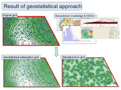
 Exploratory Spatial Data Analysis (ESDA) is a group of techniques used to describe and visualize spatial distributions, to highlight patterns affecting the distribution of observations and to identify outlier values. Each interpolation technique has its own advantages and disadvantages, depending on the characteristics of the input dataset. ESDA techniques provide the GIS user with guidance on how to decide which interpolation method to use when gridding and contouring data.
Earlier this year we released a white paper entitled “Exploratory Spatial Data Analysis – Optimizing Interpolation of E&P Datasets” for use by Petroleum exploration and production (E&P) sector geoscience and GIS professionals. The paper, first presented at ESRI’s 2009 Petroleum User Group (PUG) Conference (www.esri.com/events/pug/) in Houston, Texas, can be downloaded for free from our Members page, and explains techniques for selecting suitable interpolation methods for creating accurate surface models using Geographical Information System (GIS) technology.
Since releasing the paper our internal R&D team has been working up the results and taking them on to the next level. We’re hopeful that we’ll have the results of Part 2 to present before the year is out.
If you’d like to keep up to date with this and other news and developments from Exprodat, please take a look at our social media channels.
Posted by Chris Jepps, Technical Director, Exprodat.


