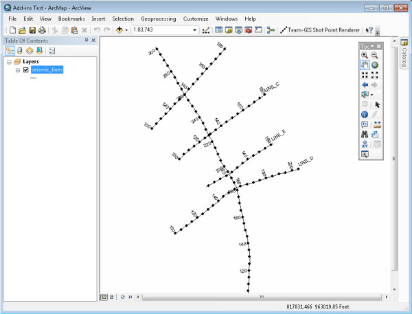
For a while now Esri’s ArcMap has had the ability to add ‘hatches’ to line layers, enabling you to post labelled measurements along lines (for further information see the ArcGIS Desktop 10 help on linear referencing and dynamic segmentation). The main applications of this in oil and gas are posting shot point labels along 2D seismic navigation lines, or posting information along well paths and pipelines.

However, the interface for adding hatches, while powerful, has never been the easiest for the occasional ArcGIS Desktop user to master. In addition it uses somewhat odd GIS-y language which the average geologist or geophysicist might not understand.
As a result a common deliverable in many of our GIS engagements with oil and gas companies has been a custom ArcGIS Desktop tool for posting seismic shot points along 2D seismic navigation lines.
In ArcGIS 8 and 9 this was done using VBA or compiled code, but in ArcGIS 10, the new add-in capability provides a way to easily share this kind of functionality. We thought it would be a good test of the process of developing ArcGIS Desktop add-ins to create one for 2D line shot point posting.
It turns out that creating an add-in like this was really very straightforward (see the Esri documentation for further information on building add-ins for ArcGIS Desktop), and having originally made the tool available for free via ArcGIS.com we’ve now included it in our Data Assistant software, which creates feature classes with the required M-values when importing 2D line data from KINGDOM, Geographix, Landmark and UKOOA formats.

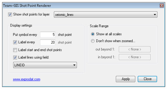
As you can see in the screengrab above, the tool interface is clearly laid out, providing easily configurable minor and major shot point intervals, and options to label shot points as well as the line name itself. In addition, it has some simple controls for configuring scale dependency, so that you can switch off the shot point symbols and labels when you’re zoomed out from the lines.
Note that only line layers that have M-values or measures will appear in the tool’s drop-down layer selector.
For more information on creating line feature classes with measures see the Esri help topic An overview of creating route feature classes.
Posted by Chris Jepps, Technical Director, Exprodat.


